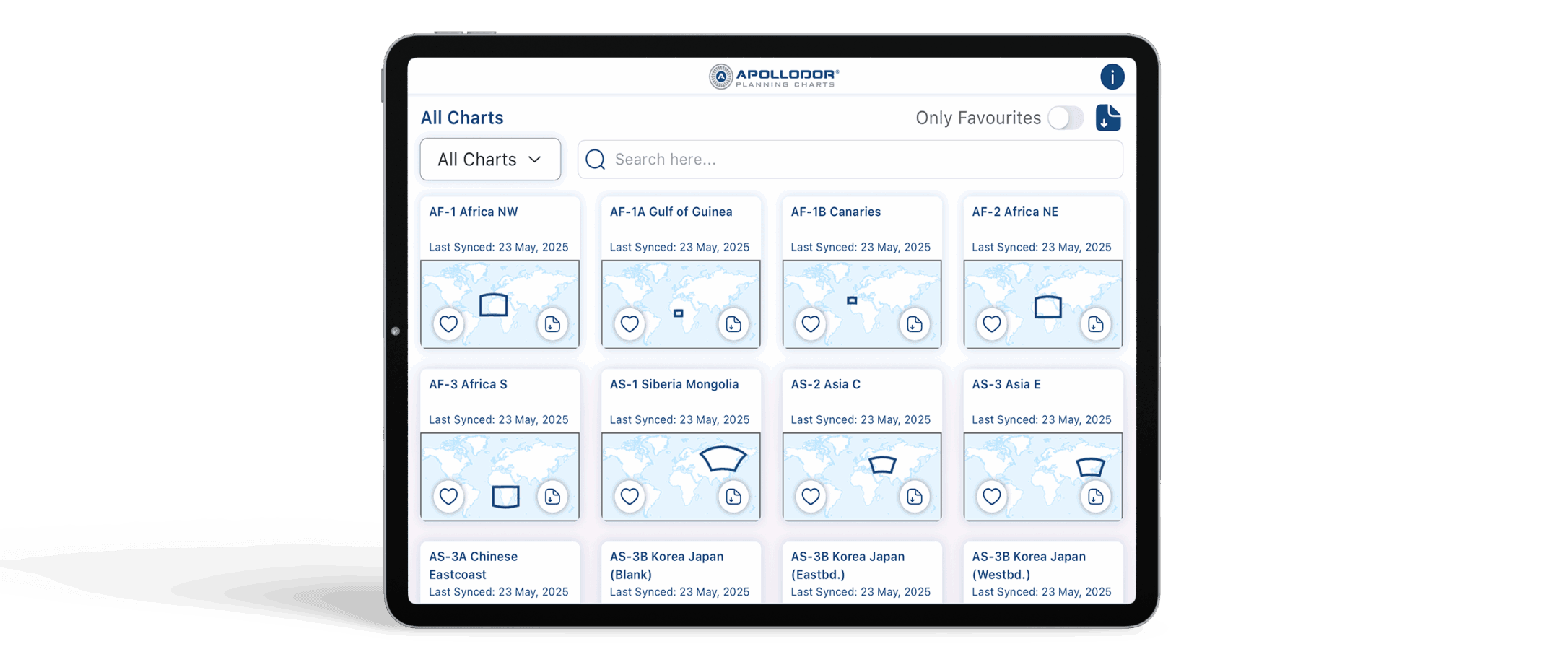
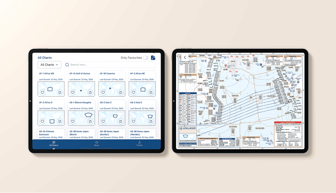
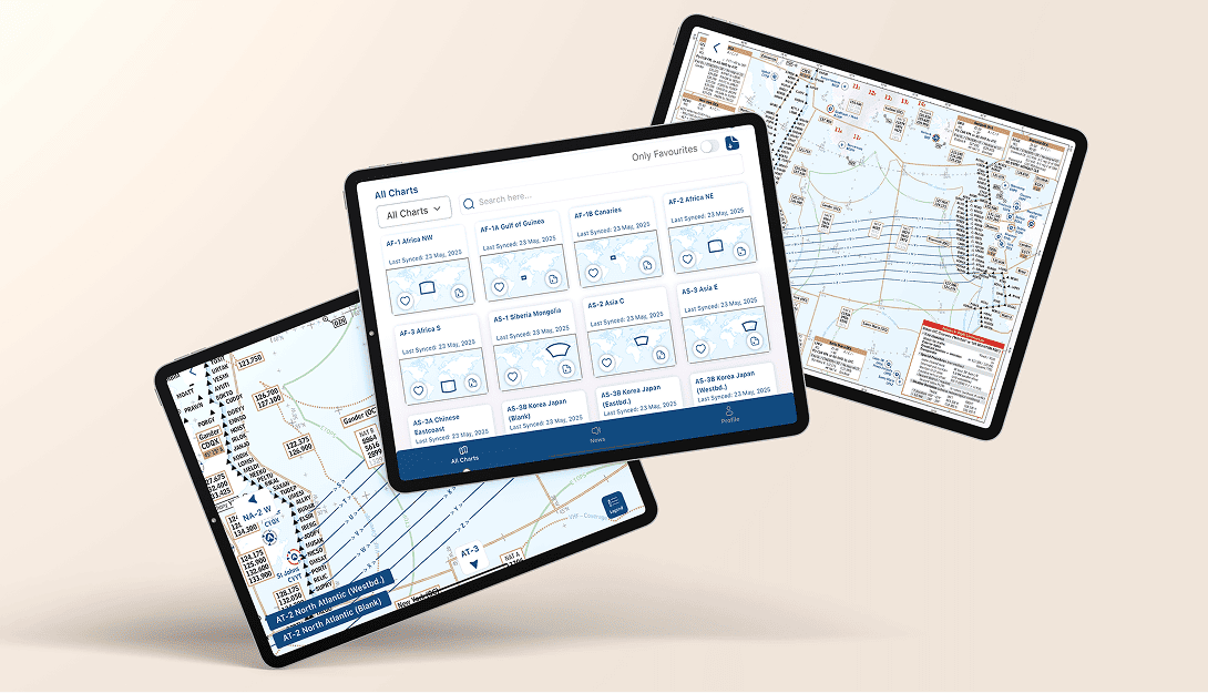
All-in-One Chart Overview
Easily browse all available charts across every global region in one organized view - grouped by region and filtered by access rights, so you see exactly what’s relevant for your flights.
Our PlanningCharts App
Access our high quality aviation charts anytime with our dedicated apps for
iOS, Windows and Android.
Our App
Easily browse all available charts across every global region in one organized view - grouped by region and filtered by access rights, so you see exactly what’s relevant for your flights.
Enable automatic downloads of the latest charts to ensure you're always equipped, even without an internet connection - ideal for use in-flight or in remote areas.
Dive into each chart with a dedicated viewer that supports directional navigation and sub-chart access - quickly switch between eastbound and westbound views with ease.
Add your own flight notes, highlights, and directional guidance directly to charts - tailor them to your needs for better situational awareness and pre-flight planning.
PlanningCharts App
Designed by pilots, for pilots. Every screen and feature of the PlanningCharts app is built for clarity, focus, and usability in flight environments.
Your charts were the best and I always found them very useful on all my flights.
The charts are incredibly well-designed, delivering exactly the information professional pilots need at a glance. With their clear layout and operational focus, they make flight preparation faster, easier, and more reliable.
I have been using these charts on and off since Gerd Puppel started posting them. I now mainly use them during route training or heavy crew rotation for an improved situational awareness. I have taken a year's subscription for the charts, there is a lot of potential in your project.
I've enjoyed your charts for many years for free. Happy to provide some compensation for the demanding work and valuable tools.
I‘m currently flying in the middle east and I just got the chance to use one of your charts (provided by a colleague and costumer of yours) on a flight to Auckland! The chart helped us a lot with the HF frequencies down there in Brisbane and Melbourne! I loved the presentation, the information and how often you updated!
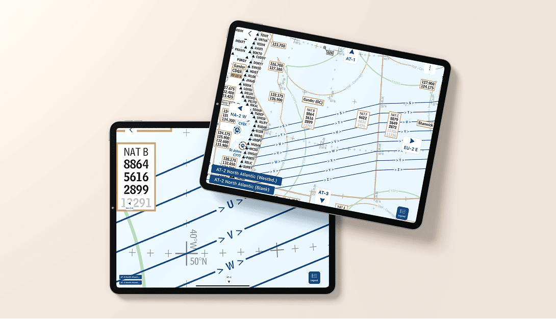
I downloaded your charts yesterday before my LAX-LHR sector and I have to say that I found them a great tool for improving situational awareness, with the information presented in a simple to interpret format. They are a bit like our old paper flight progress charts but with the bonus of being updated daily and with the NAT tracks overlaid. I found myself referring to your charts more often than to the official enroute map.
Beautifully simplified charts with all the essentials — no distractions, just pure usability. Ideal for efficient planning of my north atlantic flights.
We update our charts several times per day according publication of NAT- and PACOT-Tracks. Also daily NOTAMs and changes in country AlPs are included, e.g. if a RWY is closed by NOTAM it is directly reflected in the Airport Symbol / Airport Data table. On top there is a lot of your feedback incorporated in our Procedure-Boxes and Attention-Getters reflecting our users pilots knowhow.
After tapping on the screen, the navigation buttons appear. (Swipe-mode is activated.)
Now you can either click on these buttons or drag/swipe them to navigate to the next adjacent chart. If there is a sub-chart / destination chart corresponding to the chart you are viewing, there are blue buttons to directly navigate to that sub-chart.
Every time you open the app, there is an automatic check if new charts are available. If yes, an update of previously downloaded charts is initiated.
You can also initiate a manual download of all charts with the button in the upper right corner on the main screen.
If a chart is available offline, this is indicated by the blue download button in the chart preview.
To download / Delete a single chart, please press the download button on every thumbnail of the chart on the main page.
You are allowed to install the app on multiple devices.